
Explore emerging technologies in geotechnical instrumentation from 2018–2025 — covering wireless sensors, fiber optics, UAV mapping, IoT networks and digital monitoring.
The past decade has seen rapid innovation in geotechnical monitoring, driven by advances in sensing, communications, and data analytics. Advances in wireless sensors, fiber optics, and real-time data platforms are replacing manual surveys with connected systems. In this first part, we explore how modern tools are improving monitoring for slopes, tunnels, foundations, and dams. Below we summarize key innovations by application area.
Slope Stability Monitoring
Monitoring of landslides and slopes has benefited from low-power wireless sensor networks. For example, LoRaWAN-based nodes can interconnect tiltmeters , extensometers , piezometers etc. over kilometers with minimal power . A 2022 study demonstrated a LoRa‐IoT landslide system with self-organizing nodes that maintain stable, long-range links and alarms in real time. Distributed fiber-optic sensing (especially Distributed Acoustic Sensing, DAS) is also emerging: by converting a buried fiber into a continuous strain-rate array , landslide processes at millimeter and nanostrain scales were recently observed with unprecedented spatiotemporal resolution. Other advances include automated UAV photogrammetry and LiDAR: drones now produce 3D topography (cm-scale accuracy) of unstable slopes for change detection. High-precision automatic total stations and GNSS networks allow continuous displacement tracking of key points on a slope. These systems vastly outpace manual survey methods in speed, coverage and safety.
Read more: Integrated Rockfall Monitoring Systems and Slope Stability Analysis in Challenging Terrains
Tunnel Instrumentation
Tunnels use similar sensors, with some tunnel-specific tech. Tunnel Seismic Prediction (TSP) uses low-energy seismic sources on a TBM or at tunnel face and geophones to image ground conditions up to ~150 m ahead. This is a commercial service (e.g. by Teck, In Situ) that can detect faults or water zones without drilling or stopping the TBM. Fiber-optic monitoring is growing: fiber Bragg grating (FBG) strain cables embedded in tunnel lining or grout can continuously measure convergence and stress. Wireless IoT networks (LoRa, Wi-Fi) are being trialed in tunnels to link subsurface sensors ( inclinometers , piezometers) to surface gateways. Robotic total-stations and LiDAR scanners are also used inside tunnels to automatically map the invert and measure convergence.
Read more: The TBM Method of Tunneling: An Overview and Case Studies from Encardio Rite’s Global Projects
Foundation & Excavation Monitoring
Major innovations include fiber-optic instrumentation for deep foundations and walls. Long-gauge fiber Bragg grating (FBG) strain sensors embedded along piles or anchors can record the settlement and load-distribution on a continuous profile (vs. point sensors). A 2021 study demonstrated embedded UWFBG fibers for real-time pile load testing. Wireless tiltmeters (LoRa or NB-IoT) attached to slurry walls or braced frames relay inclination remotely. Synchronized geodetic monitoring (GNSS and total stations) is also used to watch top-of-wall or slab settlements. For deep excavations , UAV photogrammetry and laser scanning now allow frequent volumetric checks of benches and face stability without personnel exposure.
Dam Safety Instrumentation
Distributed fiber-optic sensing has transformed dam monitoring. Systems like Luna/OptaSense deploy fiber cables along embankments or in injection wells, using DAS/DTS interrogators to sense strain, vibration and temperature continuously. OptaSense’s Tailings Dam Monitoring Solution uses fiber as “thousands of acoustic and temperature sensors” to detect even minute deformations and seepage with real-time alarms.
Distributed Temperature Sensing (DTS) has also been researched for seepage detection: heated fiber optics can reveal internal water flow patterns in a dam. Other emerging tools include miniature wireless piezometers and tiltmeters with cellular IoT links, and InSAR satellite monitoring for dam crest settlement (providing broad coverage of multiple dams). These technologies give continuous, early-warning data far beyond traditional manual readings.
Read more: Step-by-Step Guide to Selecting the Right Sensors for Structural Health Monitoring (SHM)
Structural Health Monitoring (Bridges, Buildings, Embankments)
Geotechnical and civil structures now employ smart sensors and IoT platforms. For example, wireless vibration/accelerometer nodes on bridges or embankments report dynamic response via cloud dashboards. Fiber Bragg Grating (FBG) strain sensors are used on bridge bearings and walls for continuous strain profiling. Vision-based monitoring (deep-learning camera networks) is emerging for crack detection. A recent report notes that integrating fiber-optics and data analytics into “digital twin” models is an open challenge. Commercial SHM suites (e.g. by Siemens, Bentley) now combine geotechnical sensor streams with structural FEM models to predict behavior in real time. While many SHM technologies predate 2018, their connectivity (IoT, cloud) and analytics have advanced recently.
Read more: A Guide on Structural Health Monitoring (SHM)
From fiber optics to automated UAV scans, today's monitoring tools offer more detail, speed, and coverage. These systems help engineers make better decisions, faster. Continue reading Part 2 on next blog.
1. What are the major emerging technologies in geotechnical instrumentation? Recent innovations include LoRaWAN-based wireless sensor networks, distributed fiber-optic sensing (DAS/DTS/FBG), automated UAV and LiDAR mapping, InSAR satellite monitoring, and IoT-enabled data platforms for real-time decision support.
2. How has wireless technology changed geotechnical monitoring? Wireless networks like LoRa and NB-IoT allow sensors such as piezometers, inclinometers, and tiltmeters to transmit data over kilometers with minimal power use, reducing cabling costs and enabling continuous field coverage.
3. What role does fiber-optic sensing play in modern geotechnical applications? Fiber-optic sensing provides continuous strain, temperature, or vibration data along the length of a fiber, offering high-resolution, real-time monitoring for dams, tunnels, and slopes without the need for discrete sensors.
4. How are UAVs and LiDAR used in slope or excavation monitoring? Uncrewed aerial vehicles and terrestrial LiDAR scanners capture 3D topography at centimeter accuracy, enabling rapid, safe, and repeatable surface-change detection in inaccessible or hazardous areas.
5. What advantages do MEMS-based instruments offer over conventional sensors? MEMS sensors, used in inclinometers and accelerometers, deliver high accuracy, compact size, and low power consumption—ideal for integration in wireless or digital monitoring systems.
6. How are geotechnical sensors integrated into smart infrastructure platforms? Modern instruments connect to cloud-based platforms (like Encardio Rite’s Proqio) that collect, visualize, and analyze data from multiple sensor types for real-time insight and early warning.
7. What is Distributed Acoustic Sensing (DAS) and how is it applied? DAS converts a standard fiber-optic cable into a series of virtual sensors that detect strain-rate or vibration along its length, enabling continuous landslide or dam surveillance over kilometers.
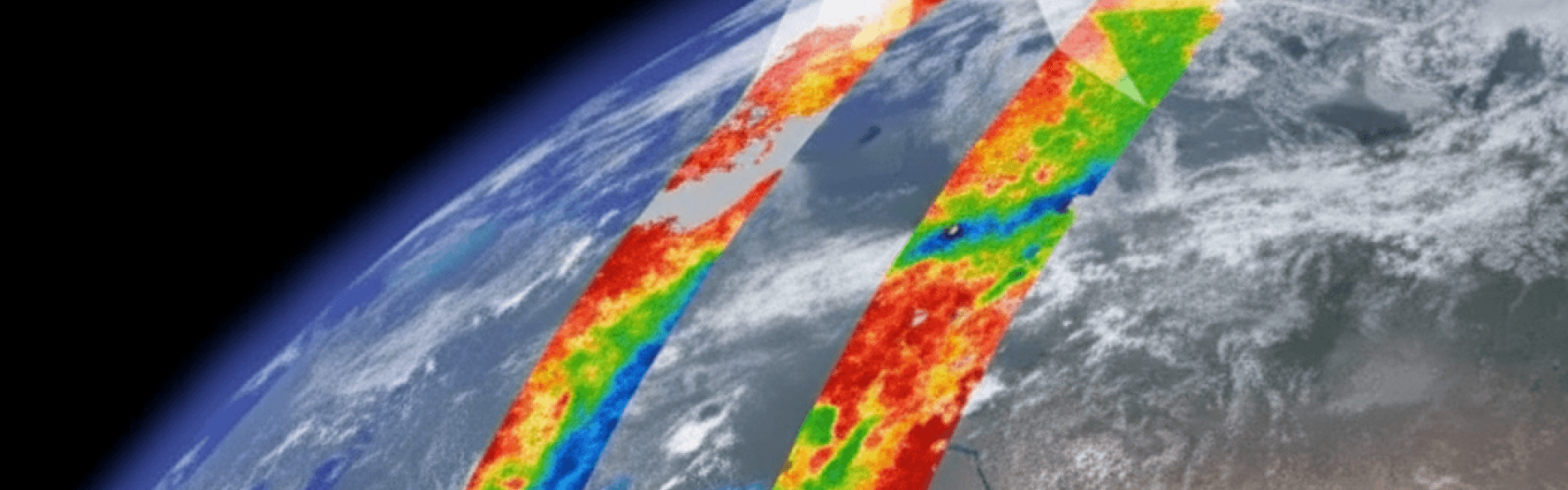
8. How does InSAR contribute to large-area deformation monitoring? InSAR uses satellite radar to measure millimeter-scale ground displacement across wide regions—ideal for monitoring dam crests, slopes, and urban settlements without ground equipment.
9. Are these emerging technologies replacing traditional instruments? Rather than replacing them, modern systems complement conventional sensors by adding automation, coverage, and data intelligence—bridging manual and digital monitoring approaches.
10. What trends are expected in geotechnical instrumentation beyond 2025? Future systems will emphasize AI-driven analytics, digital twins, autonomous sensor networks, and deeper integration between geotechnical and structural monitoring for predictive maintenance.